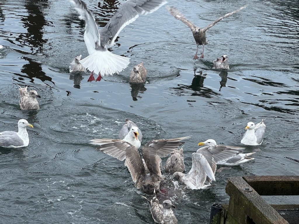
Restaurants, galleries, gift shops, tourist boats buzzing everywhere, traffic … TOFINO! After weeks of moving from remote anchorage to remote anchorage with a few rugged sports fishing marinas in between, we finally tie up at Tofino Resort Marina. Tofino is west coast Vancouver Island’s most popular tourist destination. The rain barely dampens visitor enthusiasm or ours. We are happy to be back on terra firma after a week of being confined to the boat. Tofino is a surfer town and is known for it’s spectacular beaches—which we, unfortunately, were unable to see—and the unmatched beauty of Clayoquot Sound. There were surf shops everywhere, still plenty of sport fishing, bear and whale watching tour purveyors, and of course day trips to the natural hot springs.
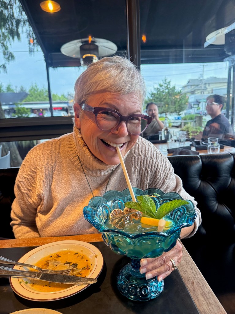
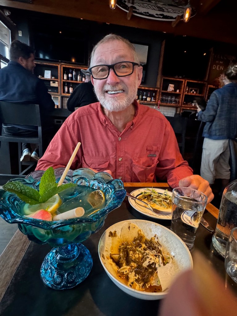
For us it was getting in lots of steps, doing laundry (of course), getting some provisions and having a couple of wonderful meals. The fresh caught halibut at Wolf in the Fog was one of the best restaurant meals of the trip, and David and I both loved their seaweed salad. They offer shared punch bowls—spiked of course—which was fun.
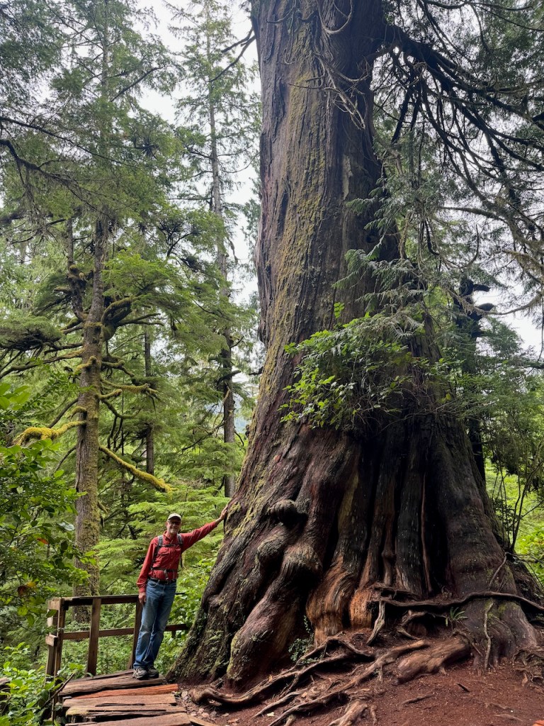
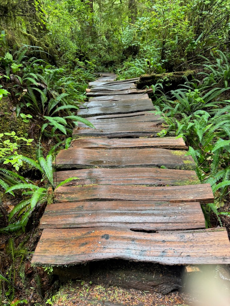
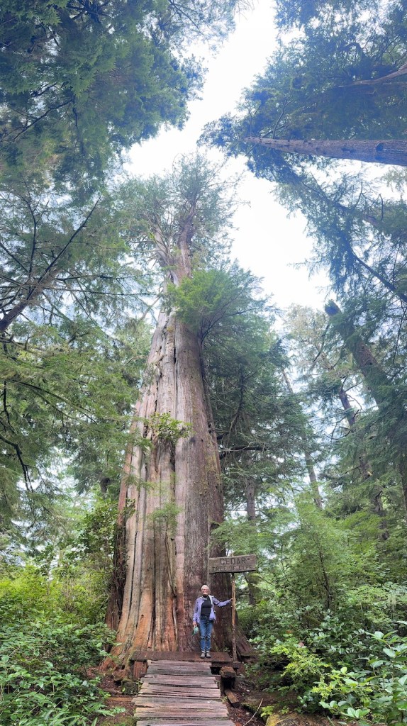
The rain was still hanging around when we took a water-taxi to the Big Trees Trail in Meares Island Tribal Park; it was just a little too far to travel in our dinghy. As wild as the west coast of Vancouver Island is purported to be, there are very few old growth trees left. Meares Island has been spared from logging and the Ahousaht tribe has built and maintains a rugged, split cedar boardwalk through thousand-year-old trees. This is not a boardwalk like the one we took to the hot springs. It is as challenging as it is beautiful. The walk isn’t long—a mile or so up and back—but being around these ancient ones takes forest bathing to a new height.
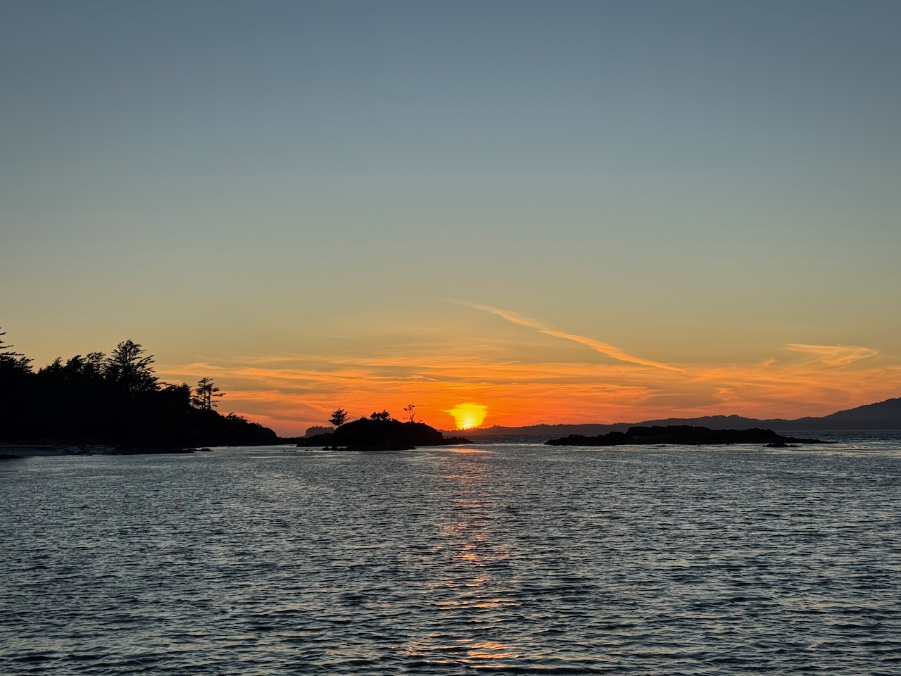
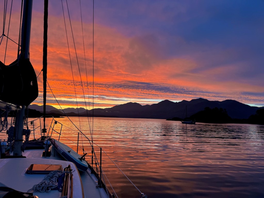
After two days in Tofino the rain was finally lifting but fog was in the forecast—August is lovingly referred to as “Faugust” here—and we need to make another ocean passage to Barkley sound. The fog is forecast to only worsen, so we are up and out early with our radar on and a couple of miles visibility. Boats were going every which way in the harbor and the passage out of Tofino is strewed with shoals and rocks. It was a bit tense. We head well offshore with the fog thickening to pea soup at times—obliterating any chance we had of seeing Tofino’s famed beaches. Cold, gray, rolly seas—and not enough wind for our sail to keep us stable—made for a chilly, miserable five hours. But just as we worked our way through another rock-strewn passage the sun burns through. We squeeze onto the 52-steps dock in Ucluelet in bright sunshine—the first sun we’d seen in a week—and exhaled.
Ucluelet is a much more laidback version of Tofino. We only stayed one night, and I wish we had taken more time. We can get there by car—same for Tofino—and I’d like to go back some day. But we were anxious to get out to the Broken Group Islands in Barkley Sound, one of the areas we’d most looked forward to exploring.
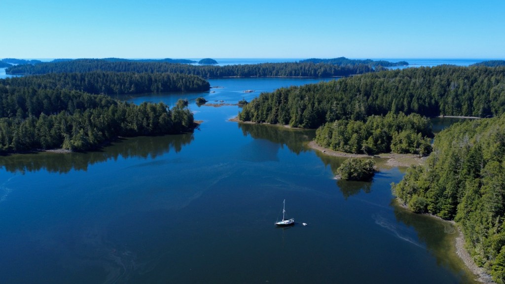
Our first anchorage in the Broken Group, which lays within Canada’s Pacific Rim National Park Reserve, was spectacular—a white sand beach, beautiful vistas, and a great hike. We had no protection from the wind, however, and a cold wind off the Pacific came up in the afternoon taking all the warmth from the sun and driving us below deck. We moved on the next day looking for an anchorage with better wind protection. The deeper we went into the archipelago, however, the murkier the water became. There was some kind of an algae bloom in Barkley Sound, resulting in green/brown, foamy, and completely opaque water.
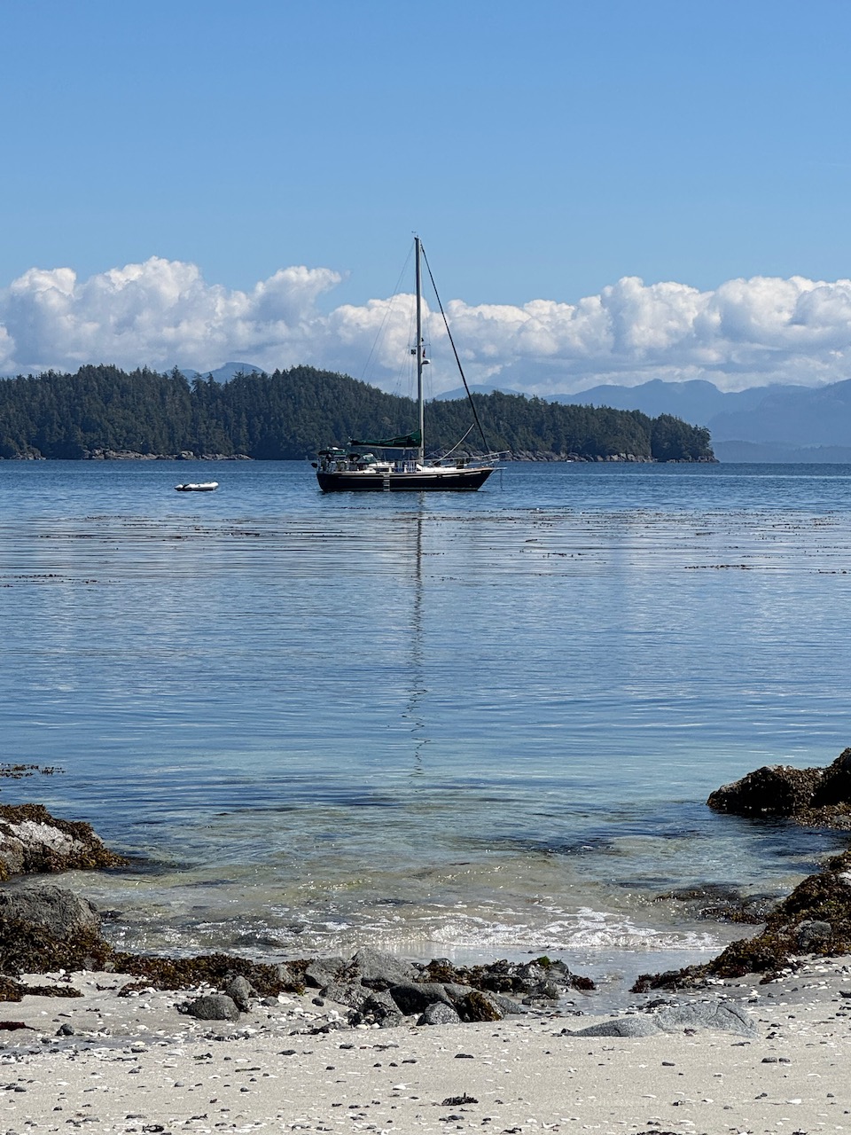
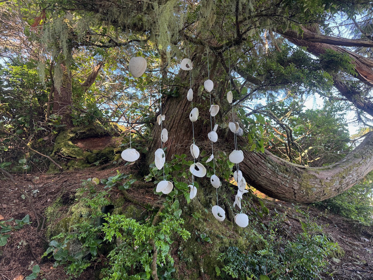
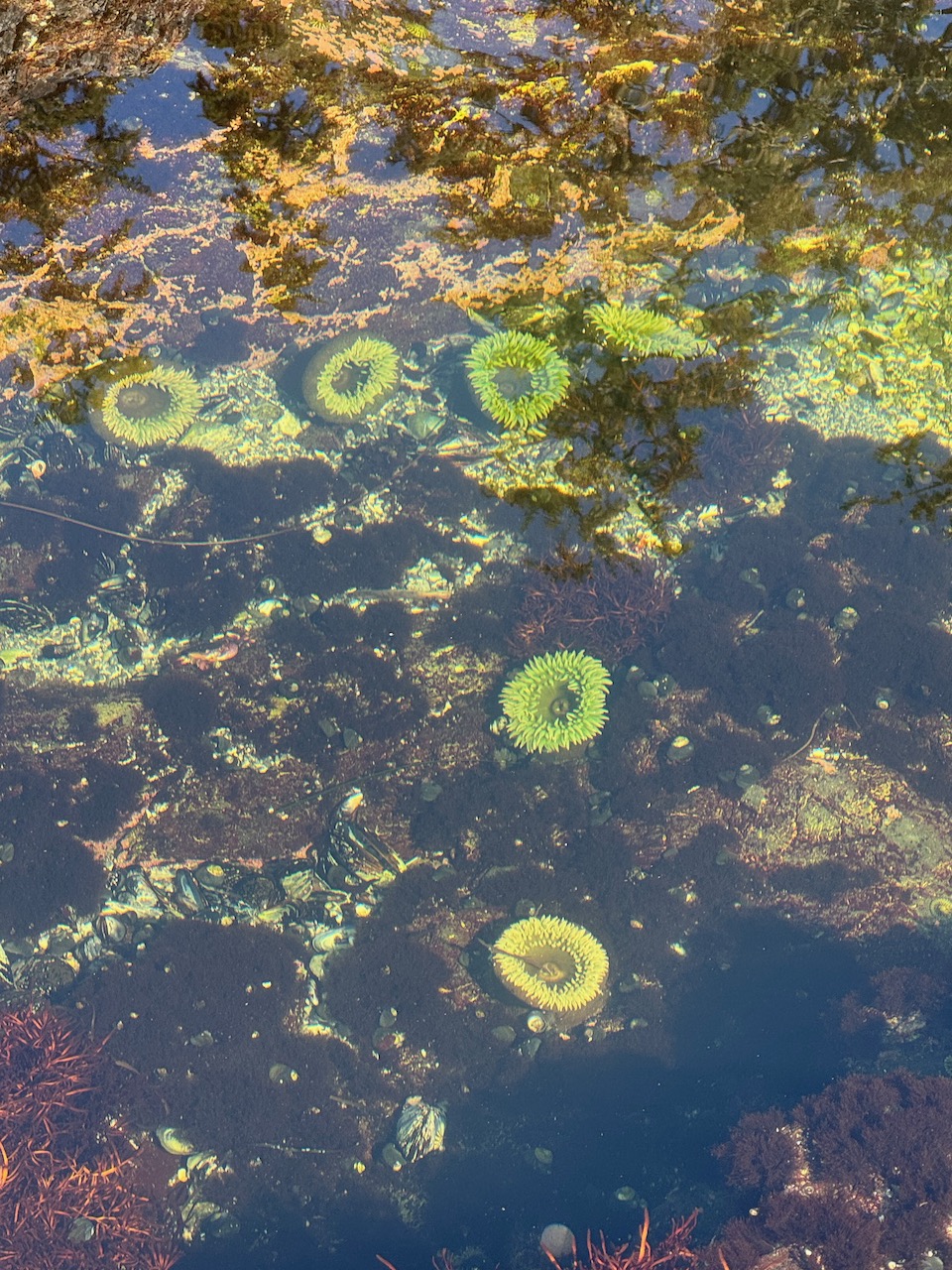
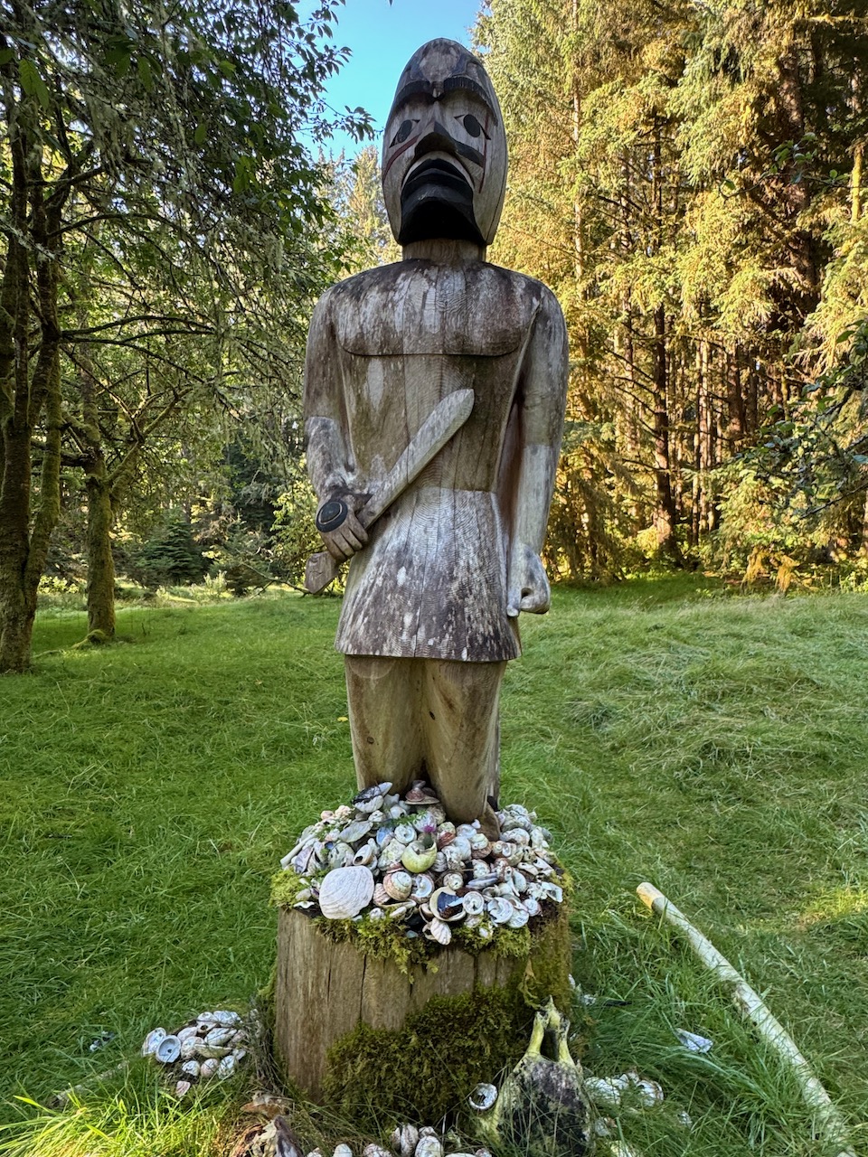
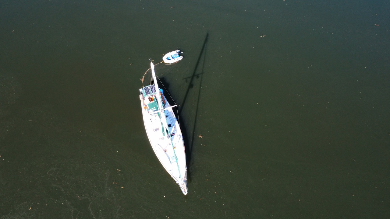
Clockwise from top left: The beach at Clarke Island in the Broken Group; Anchored between Clarke and Owens Islands; Visitors leave art for us to enjoy; Large green sea anemones on Benson Island; Tseshaht First Nation People had a large year-round village on Benson Island for centuries; Oceana on mucky water.
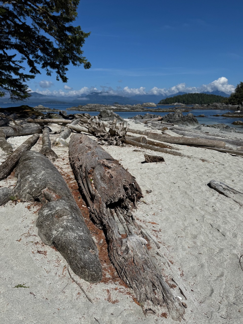
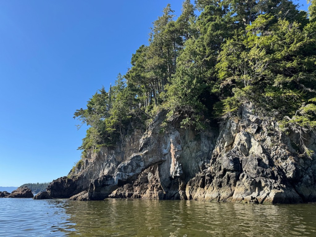
The islands are mostly flat, so we had trouble finding anchorages to tuck out of the wind. After one more night in Joe’s Cove in the Broken Group, we decide to try The Deer Group Islands closer to Bamfield on the south side of Barkley Sound. We find a lovely little anchorage between two islands named Robbers Passage. The coastline of the islands here is full of sea caves, tunnels, and arches. We explore the wonders of geology in our dingy and land on a sandy beach to do a little beachcombing—a favorite pastime.
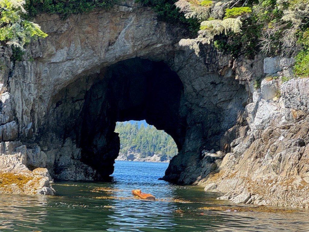
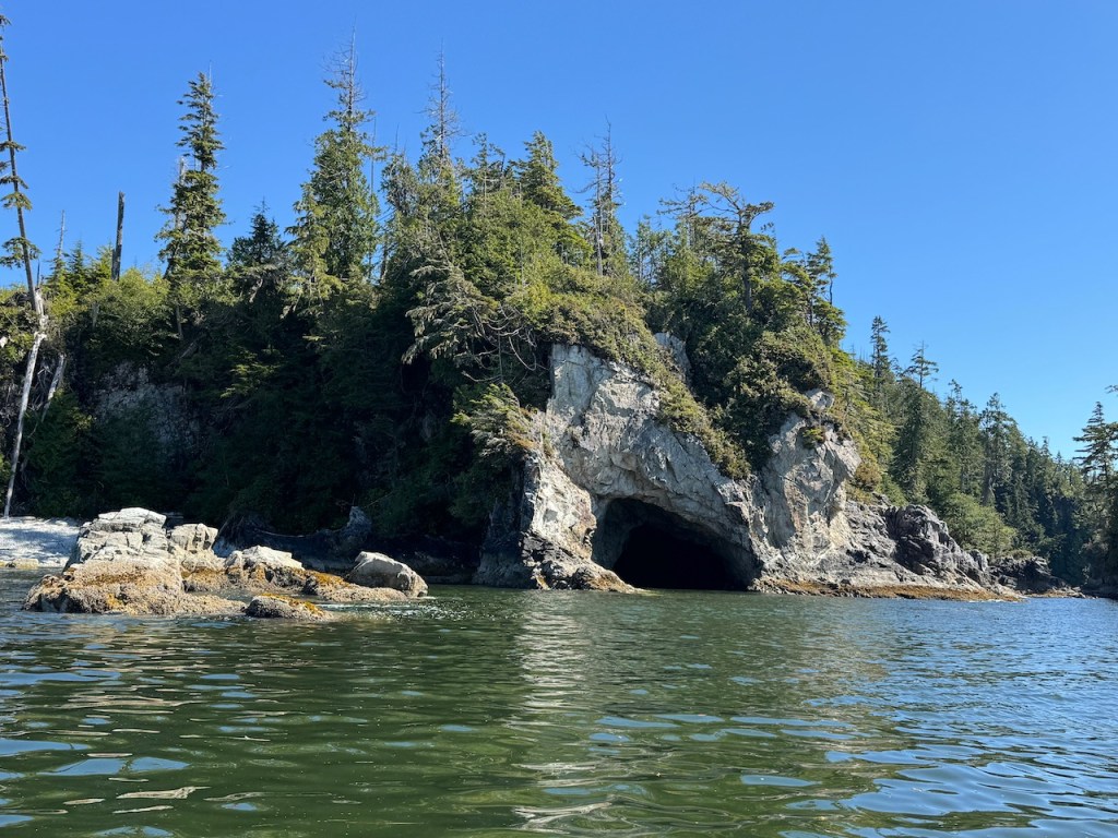
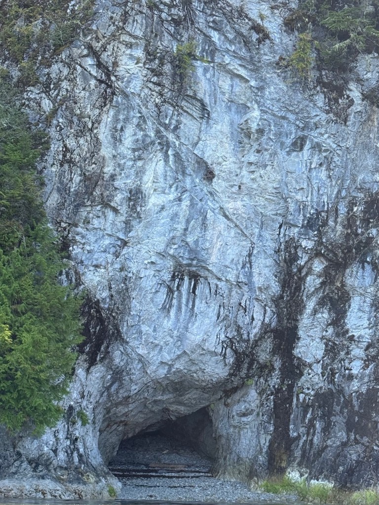
Sea Caves and arches in the Deer Group Islands.
Barkley Sound is the last major inlet on the west coast of Vancouver Island. Once we leave Barkley Sound, it’s 75 miles to Sooke, the next completely secure anchorage. Faster boats will do it in a day. It will take us two, with a duck in for the night at Thrasher Cove in Port Renfrew, about halfway. Thrasher Cove often lives up to its name and is not well liked by cruisers who’ve anchored there, but we have little choice. I was nervous about the long passage, and not looking forward to the anchorage. All for naught.
It was a beautiful, calm, sunny day and we surfed large following swells down the coast. Riding the current we cruised an astounding seven to eight knots for extended periods. This part of the coastline is spectacularly beautiful with rugged steep cliffs, sea caves, and waterfalls crashing down to the sea. And the anchorage? We could see that in unsettled weather it would be uncomfortable, but we had complete calm. The worst was not the swell but the wakes from small fishing boats zooming by.
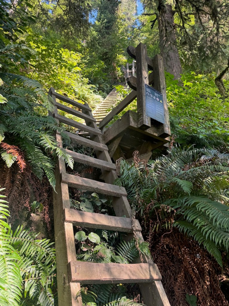
We dropped anchor in front of a beach covered with small tents that is the first stop (or last if you hike from north to south) for backpackers hiking the challenging West Coast Trail. As soon as we are anchored, I paddle ashore to stretch my legs and explore—a luxury after hours in the cockpit. Asking a hiker how hikers get to the beach from the cliffs above he points to a buoy hanging from a tree. “Go look there,” he says. “It will give you a glimpse of what the trail is like.” I scramble over some logs and walk into the trees behind the buoy. To my left are some bear-proof boxes where hikers can store their food. To my right is a ladder. It went up and up and up and up. I couldn’t see the end of it! I climbed it the next morning for some exercise (unfortunately, forgetting to count the rungs) and my heartrate goes through the roof. I am so out of breath I can’t even begin to imagine climbing it with a pack on. There are some things I will never do in the life I have left. Hiking the West Coast Trail is one of them.
The next day we travel the second leg of this passage down the coast to Campbell Cove, a sweet anchorage just southeast of Sooke. It’s another sunny, calm day which makes for a long but easy passage down the Strait of Juan de Fuca—and it becomes our whale day.
We stop to watch two whales that I still have not been able to identify with confidence. But I believe they were Baird’s Beaked Whales. Later, this huge black column comes shooting out of the water and down with an enormous splash! A breeching Humpback just 200 yards from our boat! After anchoring, we see whale-watching boats at the front of the bay. The Orcas came by not long after we’d turned the corner. I can see them with my binoculars, but they are so far away it doesn’t really count.
The Strait of Juan de Fuca has some serious currents. When you have a boat that only goes six knots, a two-knot current against us can slow us down to a four-knot crawl—and we are still using six knots worth of fuel. So, knowing the current strength, direction, and when it changes is just as important as knowing the wind and waves. For our last leg into Victoria, we will need to wait until noon the next day to have the current with us.
We are anchored next to a little beach where we can easily access an East Sooke Regional Park trail—a short and beautiful seaside hike. So, we jump on our paddle boards to transit the short distance between the boat and the beach to go hiking. The morning is completely still—the water calm and glassy. David gets to the beach ahead of me and calls out that the beach slope is steep enough to walk off the front of the paddle board without getting shoes wet. I’m thinking, ‘cool!’ But you know how sometimes your brain just hiccups—my dear friend Mary calls it a “brain fart”—and you miscalculate? Well, for some reason, with that piece of information my brain told me I could remain standing on the board all the way up to the beach and then just step off. I never stay standing on my board all the way to the beach. If the board stops suddenly when it shallows out the momentum of my body just keeps going … right into the water. So, I bet you can guess what happened. One minute the board is gliding smoothly into the beach, the next it stops suddenly and I’m ass over teakettle into the water. After first making sure I’m okay David says, “Why did you stay standing?”
My brain still hasn’t caught on. I reply, “You said I could walk off the board right onto the beach!”
“You kneel down when you approach the beach like you always do,” he says, “and then stand up and walk off the board when it stops.”
“Oh.”
Duh. My brain finally recalibrates.
Dripping wet and slightly embarrassed, I paddle back to the boat for dry clothes and then back to the beach—this time my landing is perfectly executed.
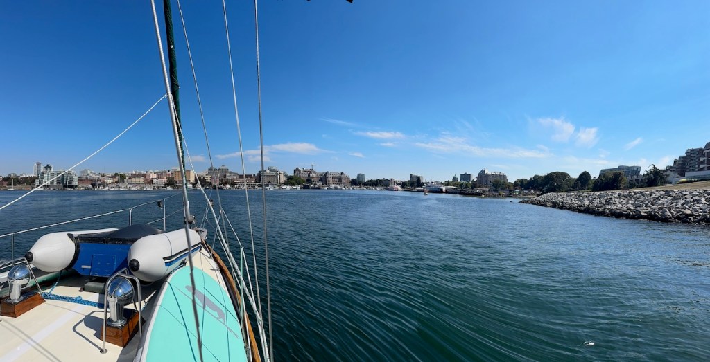
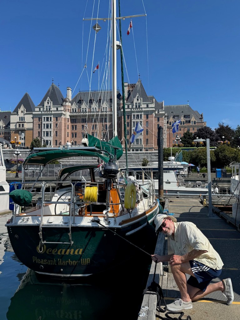
It’s time to head off to Victoria. We didn’t make advance mooring reservations because we didn’t know when we’d arrive. The Greater Victoria Harbor Authority runs four, maybe five marinas there. It’s peak season, we know it’s a long shot but go online to see if we can get moorage on short notice. We’ll take anything they will give us. We don’t care which marina, just shoehorn us in please. We’re talking plan “B” options when we get an email confirmation. They have space for us at the Causeway Marina—their most popular one. We are smack dab in front of the Empress Hotel!
It’s glorious.
What a wonderful, spectacular way to complete our circumnavigation of Vancouver Island. It felt like Canada was throwing us a party.
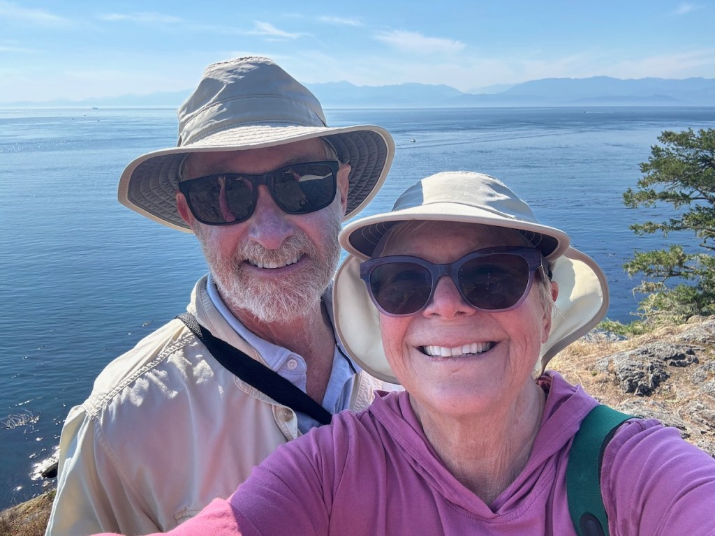
We spend three days and nights in Victoria under bright blue skies. The city is gorgeous, vibrant, and fun. We walk the waterfront and cruise the touristy shopping district. We eat ice cream and have amazing dinners—one of them made by David’s cousin who lives here. We visit with family and good friends. Just. Wow.
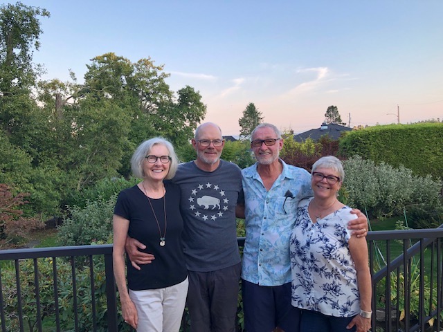
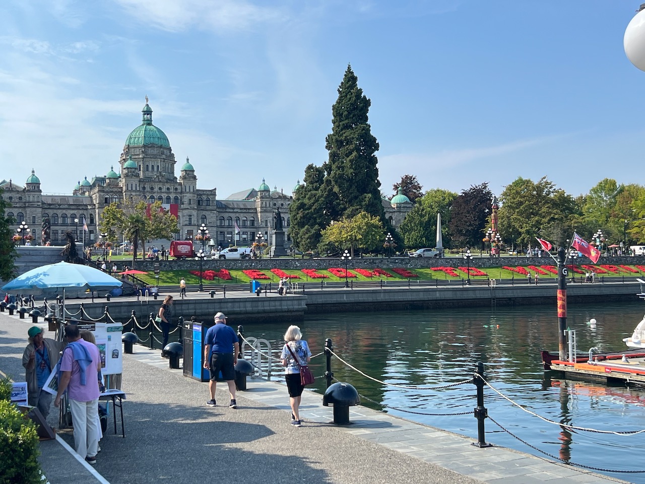
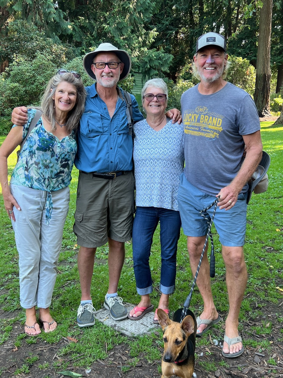
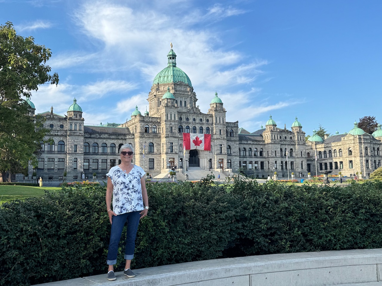
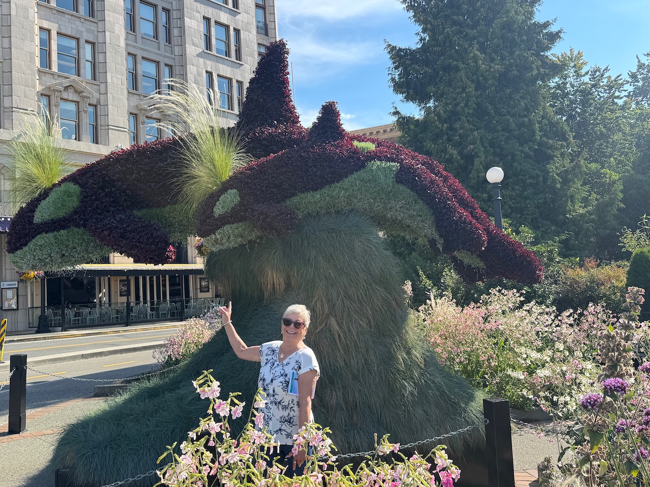
Clockwise from top left: With David’s wonderful cousins Di and Dan; Our great friends Lynn and Hugh have just returned from sailing to French Polynesia and we are so happy to see them; I finally see some Orcas! A fantastic topiary sculpture; British Columbia’s Parliment building; A beautiful, welcoming, waterfront.
We are now anchored at Sydney Spit on Sydney Island, one of the southern most Canadian Gulf Islands. We’ll spend another day here exploring and trying to eat the food we can’t take back into the US. We will re-enter US waters on Saturday and clear customs in Roche Harbor or Friday Harbor—wherever they tell us we must go. We then plan on spending a couple of days on the south end of San Juan Island before heading back across the Strait of Juan de Fuca to Port Townsend. If all goes as planned, we will be home on Tuesday, September 2nd.
I have a lot to process, and our journey is still not over. So, I’m not done writing quite yet. There are insights I want to share. For now, suffice to say that it’s hard to believe this particular journey is coming to an end.
And …
WE DID IT!!!
I couldn’t be more grateful, or proud of us.
Have a wonderful Labor Day Weekend.


Leave a reply to Brian Creasy Cancel reply