Note: I’d almost completed the post below and had intended to post it last night when we received a text from fellow cruisers: “Have you seen the Tsunami alert?” We hadn’t. Our radio was off and we were busy looking over maps and charts planning our next day.
An 8.8 earthquake had hit in the Pacific Ocean off the coast of Russia, triggering a tsunami. The entire BC coast and west coast of Vancouver Island had been upgraded from “watch” to “alert.”
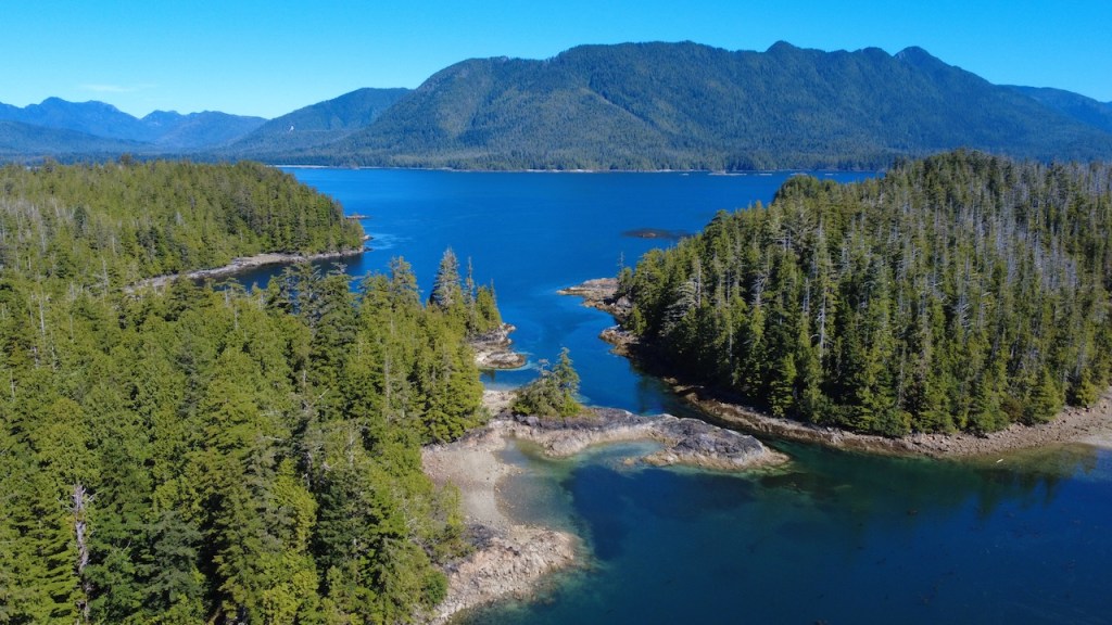
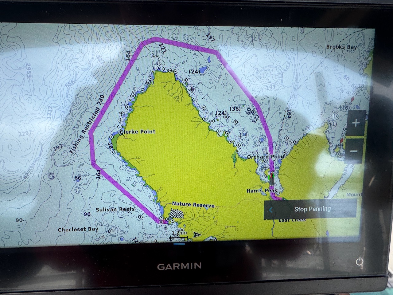
We are anchored in the Bunsby Islands, a group of small islands and islets just off the coast surrounded by numerous rocky shoals. We were vulnerable and had no where we could go. We had to prepare to ride out whatever was coming.
According to the BC Tsunami Emergency information we could get, a small wave was due to hit at about 11:30 PM. We had no idea how that would affect us in our small anchorage in the low-lying islands. It was 9:30 PM—we had a couple of hours to prepare. We were not worried about being swamped by a wave, it was forecast at only a foot over normal tide level. The potential danger was strong currents pulling us into the rocks that surrounded us. We readied our dinghy, and filled our dry bags with protein bars, first aid supplies, flashlights, supplemental batteries, knife and warm clothes. We readied our portable radio and Garmin InReach, which would provide emergency SOS, maps, and GPS of our location and made sure everything was fully charged. We got our flair gun, flairs and airhorn ready. We contacted our kids, so they could monitor our position. With AIS they would be able to see if our boat moved substantially.
At 11:00 PM we put on our lifejackets, headlamps, and radio headsets. We clipped on our emergency tethers. We turned out all the lights on the boat so our eyes would adjust to the dark and went into the cockpit to watch the water depth beneath us on the chart plotter. Then we waited. We wanted to be ready to start the engine to hold us in position against current if need be.
I’d been in touch with a friend who lives on the coast in Hawaii. She had been evacuated to higher ground. The tsunami was going to hit there first and might give us an indicator of what we were in for. At 10:44 PM she texted it had not amount to much and they were out of danger— she was headed home. Fingers crossed it would be the same for us.
The sky was dark and clear with only a sliver of moon— the Milky Way shined in all her glory. I can’t remember the last time I could see so many stars. It was so quiet, calm, and still outside.
11:30 came and our depth rapidly increased by about a foot, but the boat did not swing or rock, there was no detectable swell. We watched the depth move up and down by a foot three times, and then settle. That was our tsunami!
It’s now Wednesday morning, July 30. We are laughing over our coffee. It was a scare, and it reminded us of how vulnerable we are to forces out of our control. In the end it was good emergency practice and then only thing we suffered was a little less sleep than usual. It’s a bluebird day and we plan on moving on to Kyoquot Sound, where we will be spending a few days. We will be on the west coast for five more weeks.
The big adventure continues.
“Cape Cook is the northwestern tip of Brooks Peninsula. Rocks and shoals extend offshore from Cape Cook nearly to Solander Island. The Cape Cook/Solander Island area can be a dangerous patch of water. When conflicting currents meet accelerating winds, conditions can sink a boat.”
These are the words we’ve been reading for months leading up to this trip and for the weeks we’ve been cruising. Rounding Cape Scott and then the Brooks Peninsula can be the most dangerous and harrowing passages coming down the west coast of Vancouver Island. Captain Cook called it the Cape of Storms. Again, it all depends on the wind, waves, and weather.
After rounding Cape Scott and meeting friends in Winter Harbor, we spent several days exploring Quatsino Sound. Heavily logged and full of fish farms, the coves we found were less than satisfying. But the wind was blowing strong around Cape Cook and we would need to wait a few days for a better forecast before continuing south.
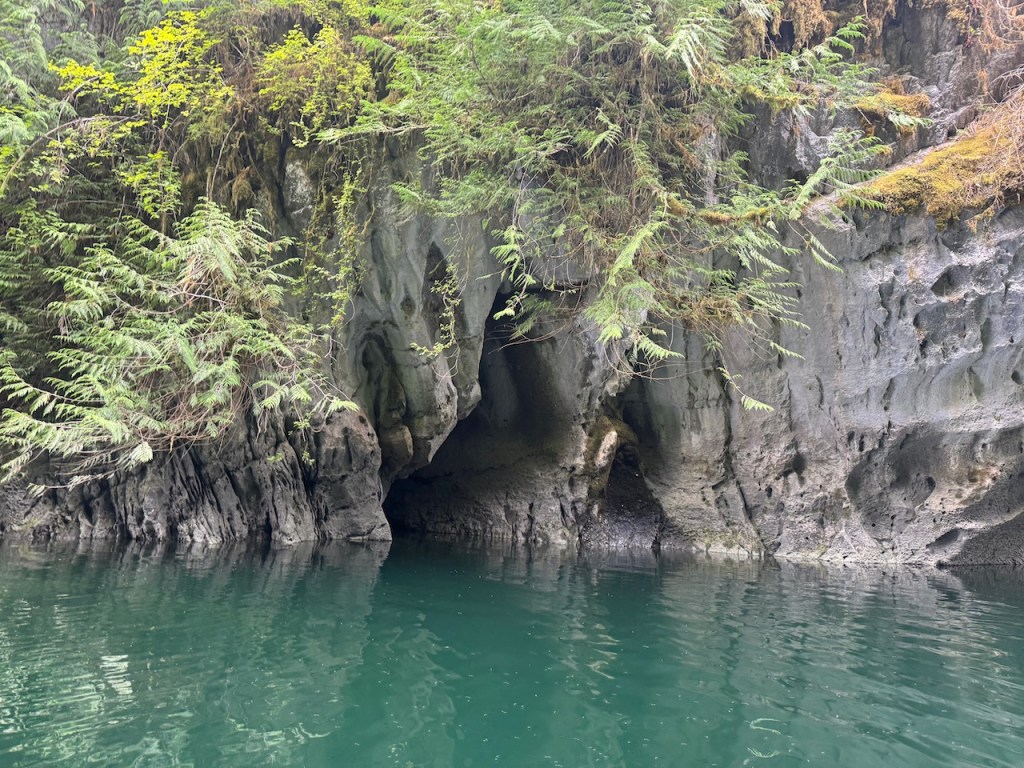
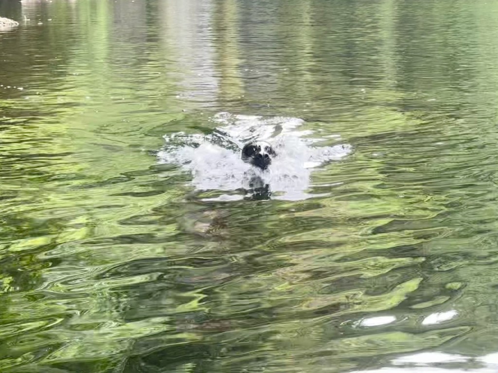
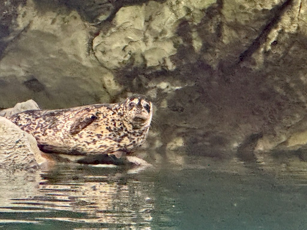
The highlight of Quatsino Sound was Varney Bay where the Marble River flows through a narrow canyon to the sea. We took our dinghy up the river into the canyon, having to walk it through rocky shallows at the entrance. Once inside high rock walls rose steeply on each side—it was stunning. Unknown to us, a rookery of harbor seals inhabited the narrow deep canyon, their tiny pups tucked into cracks and crevices along the steep rock walls. We gently rowed upriver until we reached a low set of rapids, our turn-around point, then floated, letting the river current carry us back out.
The seals and pups were curious, popping up and down out of the water to warily watch us. They seemed much less shy than the seals at home. Then, we accidently floated too close to the canyon wall where a mama seal must have had a pup hidden. She charged us, teeth bared. Startled and chagrinned at stressing her, we quickly got the paddles in the water and gave her more room.
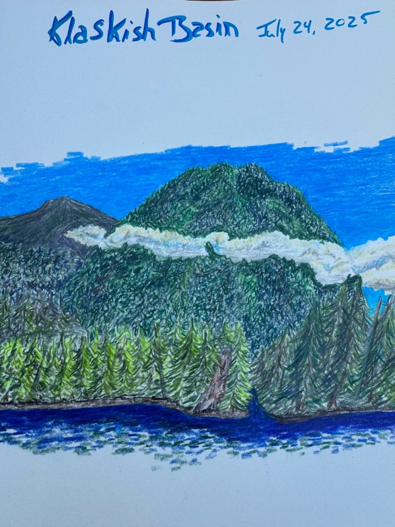
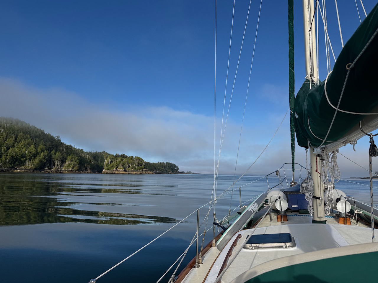
From Varney Bay we made our way back to Winter Harbor for a quick stop to fill up on fuel and water. The weather looked good for rounding Cape Cook in a couple of days. Heading offshore, we had a rolling and uncomfortable passage to Klaskish Inlet, a beautiful, protected bay accessed by a narrow channel at the northeast corner of Brooks Peninsula. It is the perfect spot to wait for the weather window we were looking for to round the peninsula. Wild and beautiful, there we got our first glimpse of this next leg of our trip. We spent a full day there, long enough for me to sketch.
The day comes to round Cape Cook. It’s sunny and the winds are light, so light that we motor all the way to Solander Island, the most notorious spot at the top of the peninsula. The conditions are mild enough that we can come closer to the island than planned and a fishing boat from Winter Harbor hails us on the radio just to say hi. A west breeze finally comes up and we raise our sails. In fair winds and following seas, we put Solander Island in the rearview mirror and sail all the way down the southwest side of Brooks Peninsula. After all our worry, it ended up being a beautiful, easy day as we cruise into the most amazing anchorage of our journey so far, Columbia Cove.
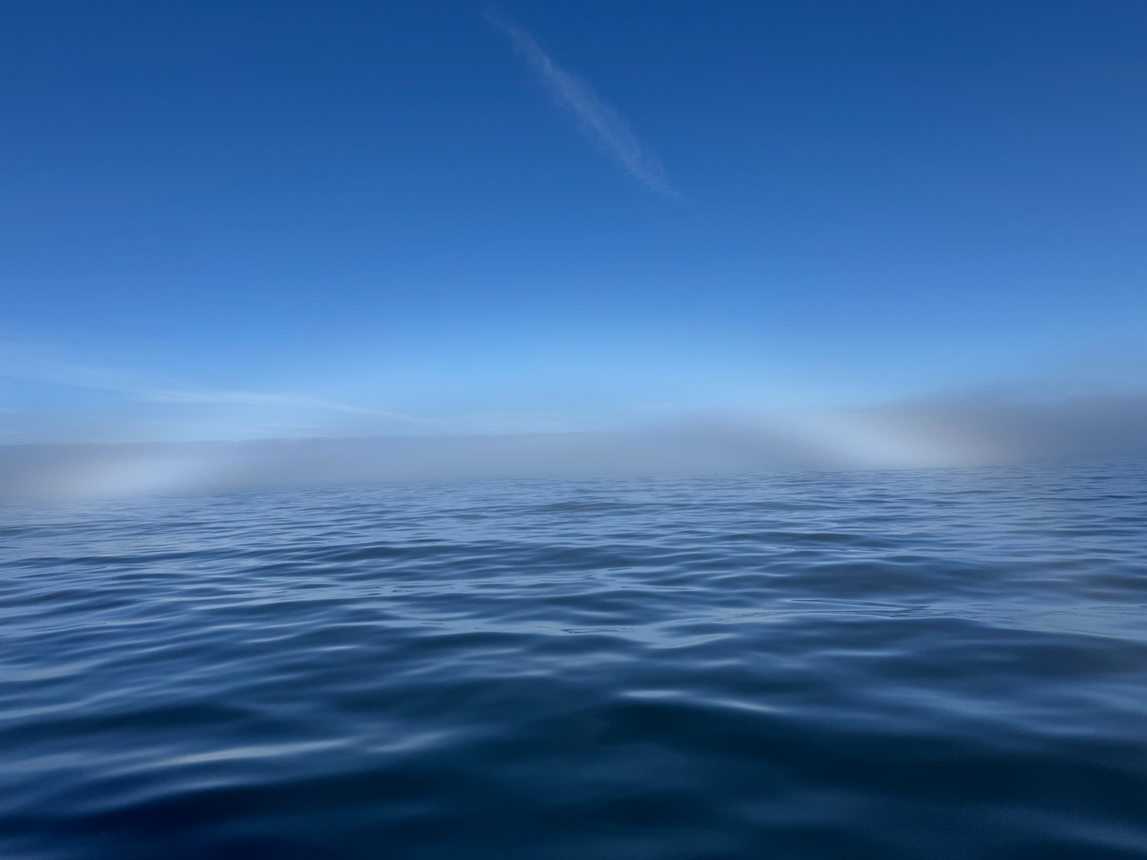
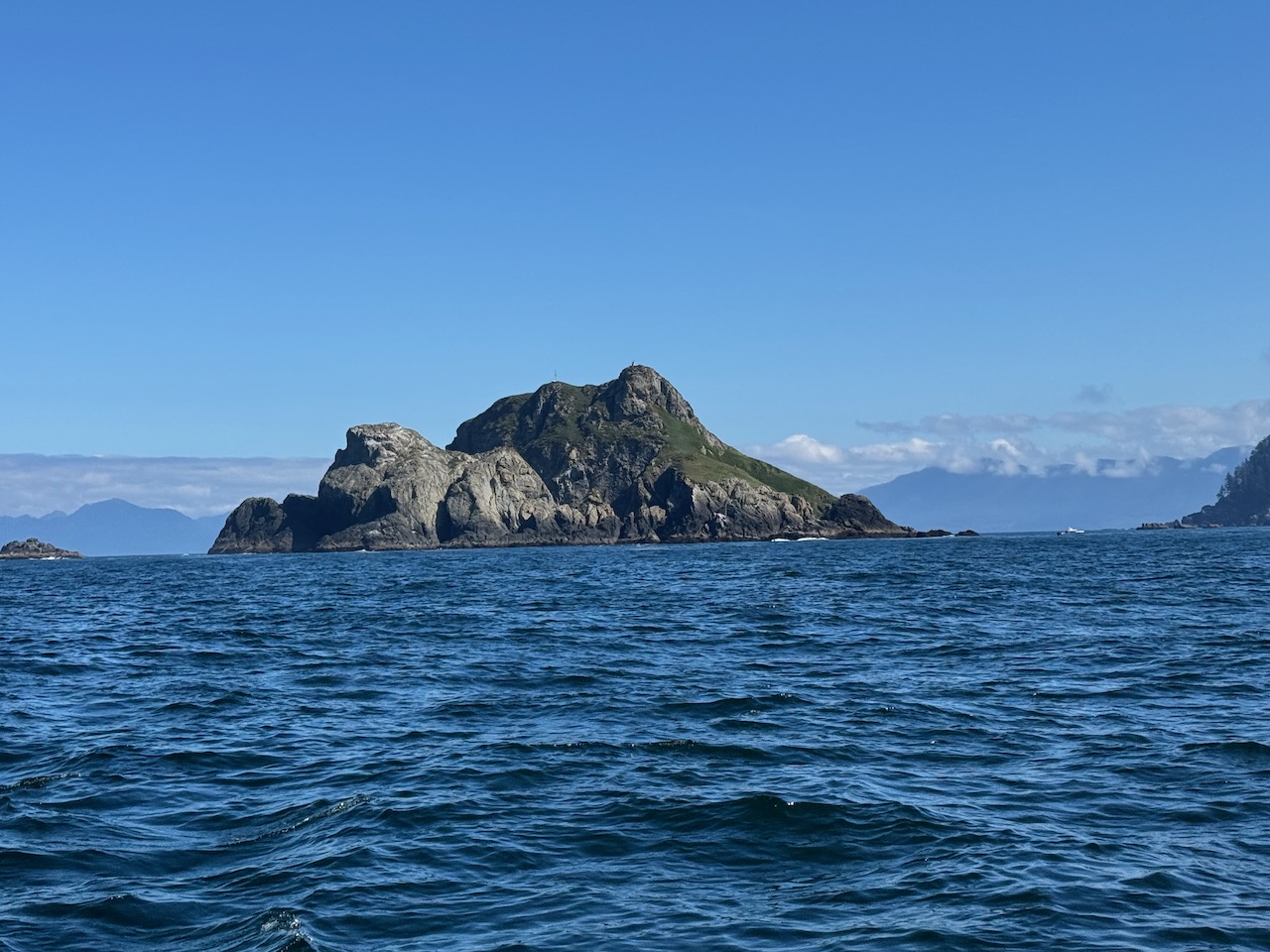
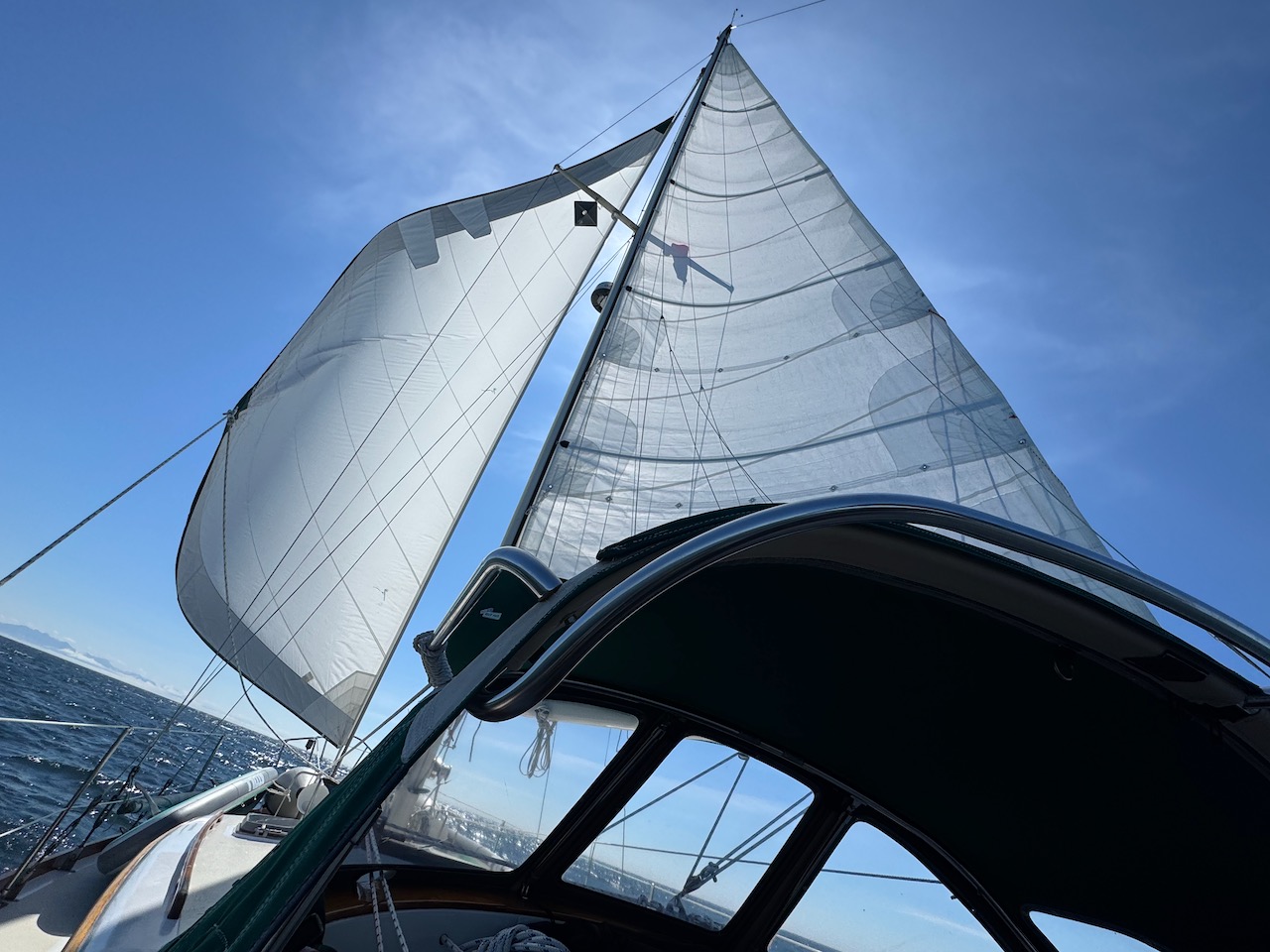
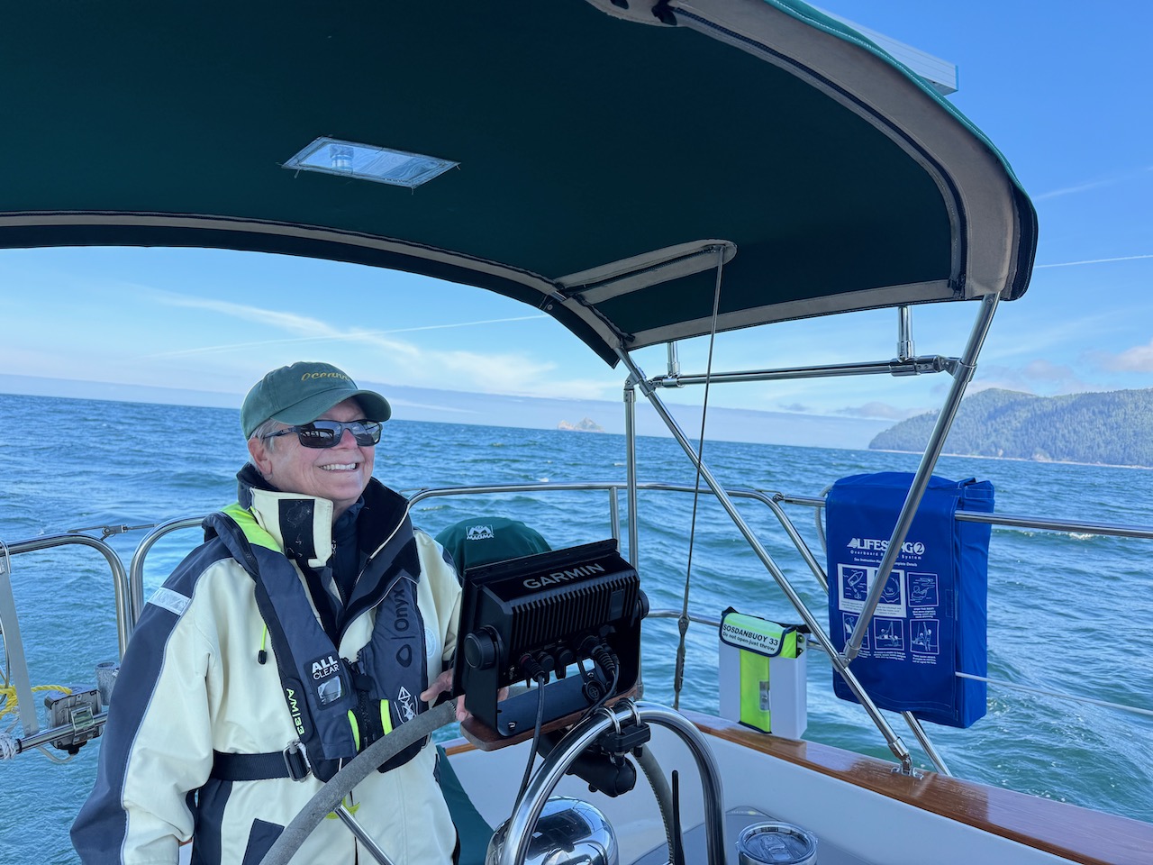
Clockwise from top left: Leaving Klaskish Basin on a calm day to round Brooks Peninsula; an unusual fog sun dog; Solander Island; flying down the south side of Brooks Peninsula with fair winds and a following sea; Victoria at the helm.
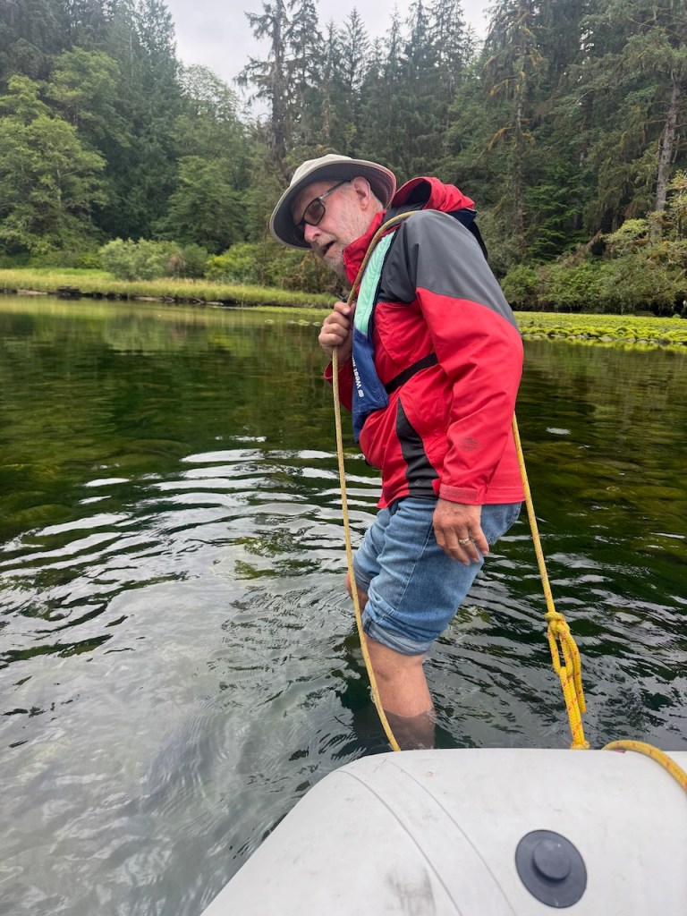
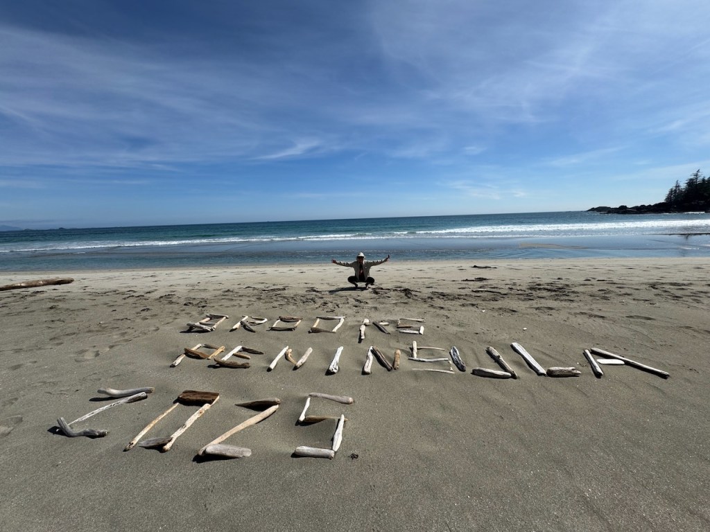
We were surprised to see three sailboats already anchored in the cove when we entered. All had arrived the night before, sailing directly around the peninsula from Winter Harbor and one from even farther north. Fortunately, there was room in the cove for one more boat. We dropped anchor behind the protection of a small island and exhaled. It was 1:30 in the afternoon, the sun was shining, and a vast white sand beach we’d passed on the way in called to us.
After some lunch we launch our SUPs (Standup Paddle Boards) and paddle into the shallow, drying cove where the trail to the beach is supposed to be, meeting some of our fellow boaters in kayaks on the way. Michael and Beverly on Sun Gypsy are old hands at circumnavigating Vancouver Island, this is their fourth time down the west side and are a wealth of information— directing us to where we will find the trail.
The trail appears to be well-marked with several old bouys hanging from a tree. But as we head down what we think is the trail we are bushwhacking and it’s not obvious. We marvel at some large old growth trees, we wander back and forth looking for the trail, and I think about bears and, here, wolves. I carry my trusty loud whistle around my neck. We finally find the trail marked by an array of junk that has washed up on the beach—hard hats, all manner of bouys, a crate, and of course lots of line and rope. I appreciate the people before us who carted this detritus from the beach to mark the trail.
After about a half mile or so we emerge from the forest onto a glorious sparkling beach, unfortunately, disturbing a young couple from one of the boats who’d been enjoying the remote beach sunshine in the buff. They quickly cover up and we all have a good laugh as we make acquaintances.
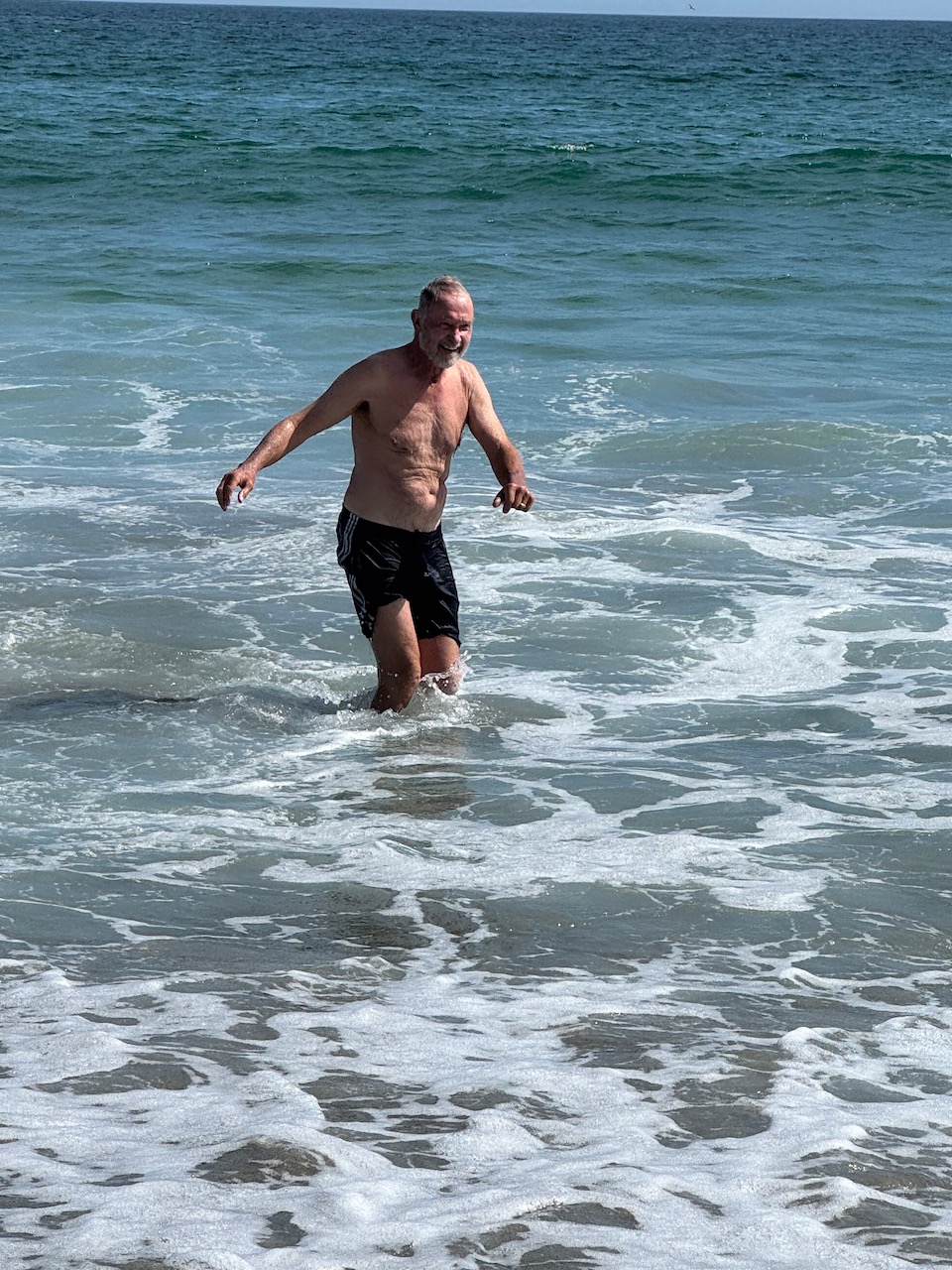
Stretching our legs on sand and surf was wonderful, as was beachcombing among driftwood. “It’s like soup,” is a common David remark when cold-water swimming. And he decided he had to go into the surf for a swim. I, being averse to cold water, declined and took pictures. David never stays in the water long, but he can always claim he took the plunge. So much fun!
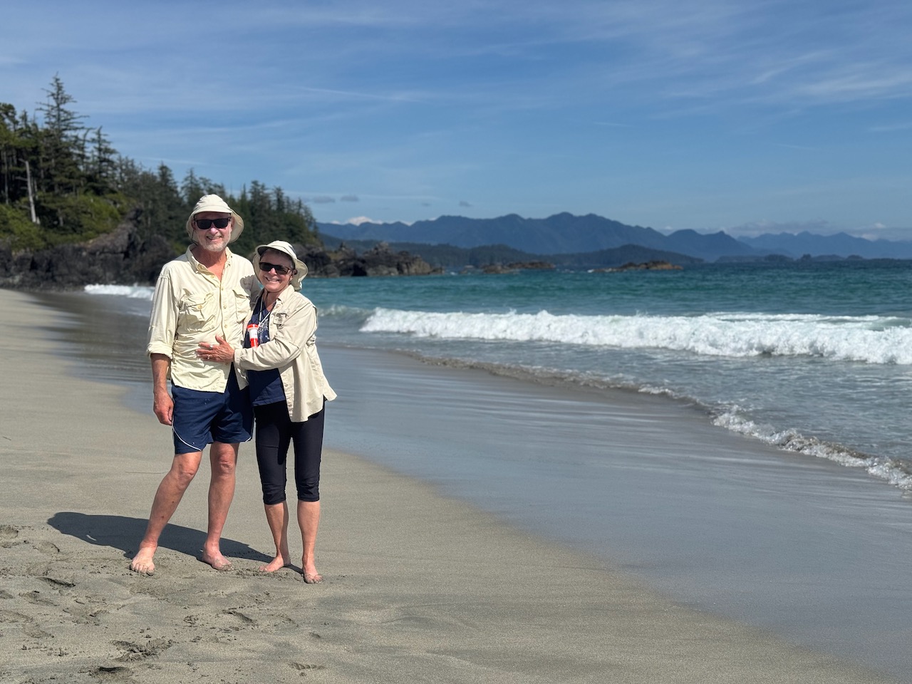
Beach walking, hiking, paddling—it was a much-needed afternoon of exercise after being mostly confined to the boat for a couple of days. It felt wonderful to move our bodies in nature, fresh air, sunshine, and such beauty. And having both Cape Scott and Cape Cook behind us was a relief.
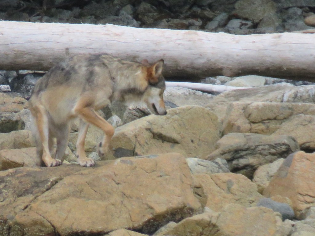
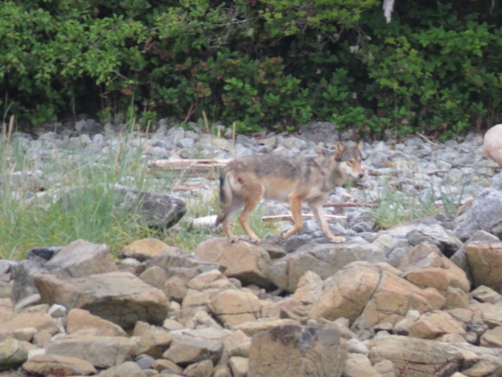
The next morning broke cool with some cloudiness. Our morning ritual is coffee outside in the cockpit and it was there, drinking my first cup that I first saw the wolf onshore some distance away. It was far enough away that my first thought was—coyote? But no, through binoculars I could clearly see that it was a much larger, long-legged canine—a grey “sea wolf.”
We are ecstatic. We’d hoped to see a wolf but it’s rare. Two of the couples anchored with us had been down the west side multiple times and had heard, but never seen a wolf. It was early. We were the only ones out in our cockpit as we watched the wolf work its way down the shore. We realized it was stalking a sea otter—lazily floating on its back eating shellfish. The wolf laid down at one point, assessing if the otter was close enough to pounce on, but the otter knew not to get too close and remained too far from shore to become a wolf meal. After giving up on the otter, the wolf worked its way down shore, coming closer to us. We were about 250’ off the shoreline. As it walked past David was able to catch a couple of pictures with our long lens. Then it walked around the point and out of sight. We’d watched it for some 40 minutes or so. What a gift.
Eight weeks into our journey we’ve experienced the incredible bounty and beauty of the Pacific Northwest. Yet, the most profound journey I’m experiencing is the wonderful loving partnership David and I have. Oceana is our life raft in this vast watery world. Every day, we must make decisions on where and when we travel and take the weather data available into consideration to stay safe. We need to agree, to trust each other, be considerate, and find harmony in our limited space. Our already close and loving relationship has only deepened. The greatest gift of this adventure is not the adventuring itself; it is the time I get to spend in partnership with my amazing spouse. I treasure every moment.


Leave a reply to Brian Creasy Cancel reply